
SedRISE
The SedRISE project was funded by NOAA Ecological Effects of Sea Level Program to support the codevelopment of modeling tools to manage sediment around coastal wetlands and embayments of Southern California. Researchers from UCI and SCCWRP engaged a Management Translation Advisory Group (MTAG) comprised of site-based, regional, state and federal stakeholders to deepen understanding of regional scale sediment dynamics and related challenges and opportunities associated with sea level rise, flood risk and coastal ecosystem management. Important contributions that have been advanced through the SedRISE project include:
- Identification of barriers and opportunities for beneficial reuse of sediment.
- Multi-decadal sediment modeling tools for planning.
- Re-envisioning stormwater infrastructure for improved sediment management.

FloodRISE
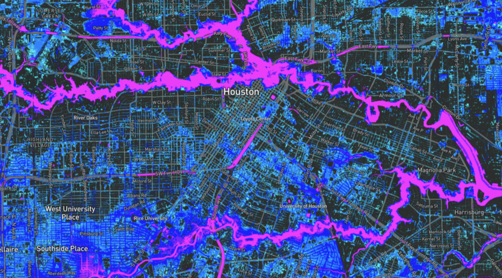
The FloodRISE project was funded by the National Science Foundation to research the potential for metric resolution flood hazard simulations to enhance flood risk management. An interdisciplinary research team worked with stakeholders in three communities affected by different types of flooding (e.g., coastal, fluvial, pluvial) to co-develop sets of flood hazard visualizations that are responsive to local decision-making needs. Stakeholder engagement was iterative and involved meetings with authorities, household surveys, focus group meetings and training sessions. The coproduced flood hazard maps are available via on-line flood hazard viewers.
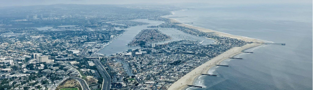
Newport Beach
Tijuana River Valley
Los Laureles Canyon, Tijuana
Oroville Dam Failure Scenario
FloodRISE also addressed emerging challenges in coastal flooding including nuisance flooding and compound flooding.

CoPe
EAGER
This is a collaborative project with researchers from across the University of California to study the impact of coastal flooding on disadvantaged communities in California. The UCI Flood Lab provides the flood hazard information used in this study using the PRIMo modeling system, and is involved in the synthesis of fine resolution flood hazard and vulnerability data.

WULF
This is a collaborative project with the UCI Houston Lab and UCI Banerjee Lab as well as with Riverside County Flood Control to improve understanding of flood risks facing communities below mountain wildland areas. Cycles of drought, fire, and flooding are intensifying and increasing both flood and debris hazards. Watch the video below to learn more.

State Parks Coastal Erosion Survey Program
This project supported by the California Department of Parks and Recreation involves monthly and/or quarterly monitoring of the Orange County coastline using Unmanned Aerial Systems. Southern California is slowing losing many of its beaches due to the combined effects of development, sea level rise, and storm activities. This work aims to improve understanding of stress points along the Orange County coastline and support coastal resilience measures.
Newport Beach Fine Sediment Management
This is a collaborative project with the UCI Coastal Dynamics Lab and the City of Newport Beach to improve understanding of fine sediment transport processes along the Orange County coastline. This work aims to inform dredging and sediment placement practices to benefit ecosystems and coastal resilience.
Zeppelin Floods, LLC
This is a startup business launched through the UCI Beall Applied Innovation. This business provides a short-term (1-5 day) forecast of street scale flooding (~3 m) to customers seeking opportunities for damage avoidance and public safety.